The BCER is committed to ensuring that industry restores their dormant sites to a pre-disturbance state in a timely manner and as efficiently as possible.
A well site is considered dormant if it does not meet a threshold of activity for five consecutive years or does not produce for at least 720 hours a year.
Under the BCER’s Comprehensive Liability Management Plan, a key focus is to speed up the rate at which inactive sites are returned to their pre-activity state. The Dormancy and Shutdown Regulation requires industry to decommission, assess and restore dormant sites under prescribed timelines.
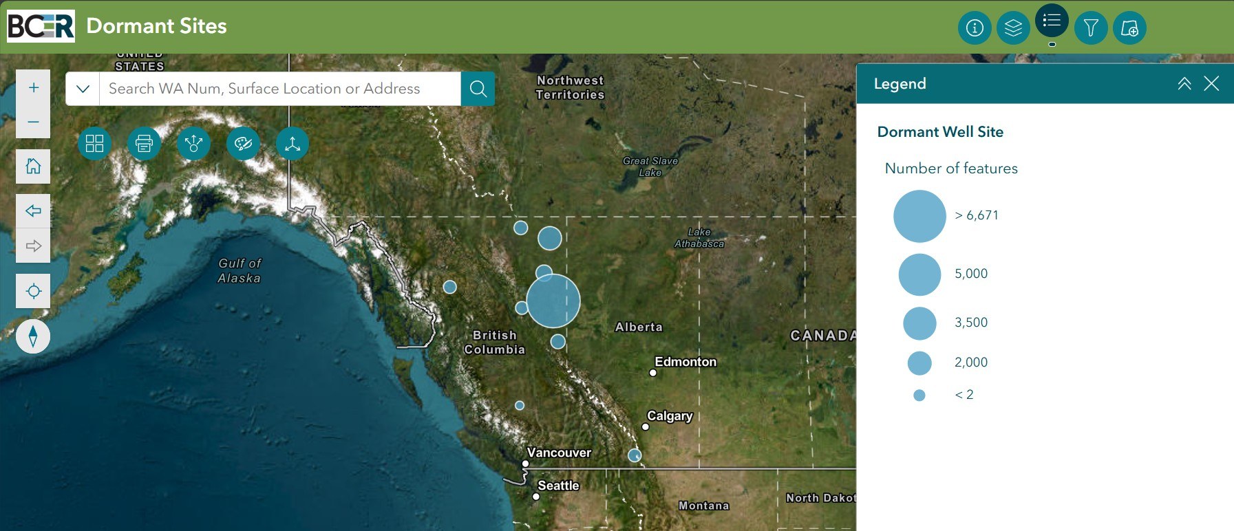
This map allows users to identify information on dormant sites, filter by operator and status, and search for dormant sites by location and well authorization number. Orphan Sites can also be shown on the map and include wells, facilities, pipelines and associated areas where a company is declared bankrupt or cannot be located.
Click on the map below to launch in full view:
Map Layers
The webmap has three primary layers.
The “Annual Work Plan Data – CURRENT YEAR” layer shows the decommissioning, assessment, and restoration work that is planned in the current calendar year using data taken directly from permit holders’ Annual Work Plan submissions.
The “Annual Work Plan Data – ALL YEARS” layer shows where site closure work has been planned by permit holders since the DSR was enacted in 2019.
The “Dormant Well Locations and Statuses” layer shows the locations and statuses of all dormant sites in B.C. Definitions of each status or stage gate can be found in the Data Definitions section below. Note, the site status is determined by stage gate declarations made by permit holders in Annual Reports submitted at the end of each calendar year. Accordingly, the site status is only as current as the last accepted Annual Report submission, with the exception of minor updates that a permit holder may report throughout the year.
If a map user is particularly interested in one type of closure work (i.e. restoration work that is planned this year or has been planned in previous years) they are able to toggle on or off, specific work-types in the “Map Layers” box.
Note, when the webmap is first loaded the “Annual Work Plan Data – CURRENT YEAR” and the “Dormant Well Locations and Statuses” layers will automatically be turned on.
Map Filters
The webmap has four primary filters to support map users.
The “Permit Holder Filter” allows a map user to identify all data associated with a specific operator or permit holder.
The “Designated Priority Site Filter” allows a map user to identify all data associated with all sites that have been formally designated as priority sites under section 5 of the DSR.
The “Dormant Well Locations and Statuses Filter” allows a map user to identify all sites where a given DSR stage gate has been declared as complete (inactive, decommissioned, assessed, or restored).
The “Annual Work Plan Data by Calendar Year Filter” allows a map user to look at work that has been planned by permit holders in specific calendar years since the DSR was enacted in 2019, demonstrating site closure work progression over time.
Data Definitions
Site Dormancy Type indicates the dormancy type of the site.
Operator
OPERATOR identifies the current permit holder of the well location.
Well Name
WELL NAME identifies the well operator, the field or area name, and the surface location of the well. This is the full well name as it is permitted.
Well Surface Location
WELL SURFACE LOCATION identifies the surface legal location of the well.
Oil and Gas Field Name
OIL AND GAS FIELD NAME indicates the field or operating area where the individual sites are located. This information supports and reinforces area-based closure programs.
Well Authorization Number
WELL AUTHORIZATION NUMBER is the B.C. well authorization number (WA Number).
Former Site (Y/N)
FORMER SITE (Y/N) identifies if a well is a former site as defined in section 3.1 of the DSR.
Dormant Status (Site)
DORMANT STATUS (SITE) describes the dormancy status of a site.
Dormant = a well that meets the dormancy thresholds set out in section 3 of the DSR.
Non-Dormant = a well that has not yet met the dormancy thresholds set out in section 3 of the DSR.
Dormancy Date (Site)
DORMANCY DATE (SITE) describes the dormancy date of a site (the date that the site became dormant).
Dormancy Type
DORMANCY TYPE indicates the dormancy type of the site.
A = a dormant site classified as a Type A site under section 4 (1) of the DSR.
B = a dormant site classified as a Type B site under section 4 (2) of the DSR.
C = a dormant site classified as a Type C site under section 4 (3) of the DSR.
Current Stage Gate
CURRENT STAGE GATE identifies what closure work has been completed at a site (the current status of the wellsite).
Inactive = decommissioning work is still required at the site; no DSR stage gates have been declared as complete (note that closure work may have been initiated or conducted by the permit holder but the applicable stage gates have not been declared as complete).
Decommissioned = all well have been permanently plugged and all surface infrastructure has been removed from the site allowing for restoration work to progress (as per section 6 of the DSR).
Assessed = site investigation has been completed to confirm the environmental quality at the site (as per sections 7 and/or 8 of the DSR).
Restored = any required site remediation and all surface reclamation work has been completed and the site has been planted with applicable ecologically suitable species (as per sections 8 and 9 of the DSR)
Decommissioned Prior to Dormancy
DECOMMISSIONED PRIOR TO DORMANCY identifies if a well was decommissioned in accordance with section 6 of the DSR prior to becoming dormant. If a site was decommissioned prior to dormancy, alternative closure timelines may apply to the site.
Decommissioned (Y/N)
DECOMMISSIONED (Y/N) indicates whether or not the decommissioning stage gate has been declared as complete by the permit holder.
Y = the site has been fully decommissioned as per section 6 of the DSR
N = decommissioning work is still required at the site
Decommissioned Year
DECOMMISSIONED YEAR indicates the calendar year in which the decommissioning stage gate requirements were met as reported by the permit holder.
Assessed (Y/N)
ASSESSED (Y/N) indicates whether or not the assessment stage gate has been declared as complete by the permit holder.
Y = the site has been fully assessed as per section 7 of the DSR
N = assessment work is still required at the site
Assessed Year
ASSESSED YEAR indicates the calendar year in which the assessment stage gate complete requirements were met as reported by the permit holder.
Restored (Y/N)
RESTORED (Y/N) indicates whether or not the restoration stage gate has been declared as complete by the permit holder.
Y = the site has been fully restored as per section 8 and 9 of the DSR
N = restoration work is still required at the site
Restored Year
RESTORED YEAR indicates he calendar year in which the restoration stage gate complete requirements were met as reported by the permit holder.
Certificate of Restoration (Y/N)
CERTIFICATE OF RESTORATION (Y/N) indicates whether a permit holder has applied for and received a Certificate of Restoration (COR) for the site.
Y = COR has been granted for the site
N = COR has not been granted for the site
Priority Site (Y/N)
PRIORITY SITE (Y/N) indicates whether the site has been formally designated as a priority site in accordance with section 5 of the DSR.
Priority Designation Date
PRIORITY DESIGNATION DATE indicates the date when a site was formally designated as a priority site under section 5 of the DSR. This date is important as it dictates closure work timelines at the identified priority site.